
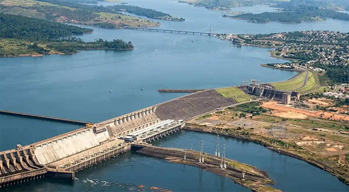
The Giant of the North is going through an unprecedented technological check-up. The Tucuruí Hydroelectric Plant, in the state of Pará, is the site of a high-precision engineering operation designed to answer a question that matters deeply to Brazil: what is the real water storage capacity of its immense reservoir today?
The stakes are high. With an installed capacity of 8,370 megawatts (MW), Tucuruí ranks among the largest hydroelectric plants in the world. Knowing exactly how much water the lake can hold makes it possible to plan power generation more efficiently, prevent blackouts and optimize the use of a resource that underpins a large share of the national grid.
That is why the study is considered essential to the country’s energy security. A reservoir whose true level is known with precision is one that can be managed far better. Every meter of stored water translates into energy available for the weeks and months ahead, and every miscalculation can mean lost generation or the risk of shortage.
Laser technology sweeps the forest and the islands
The mission, due to be completed by the middle of 2026, uses cutting-edge technology to build an ultra-detailed digital model of the region. The operation combines airborne laser profiling, known as LiDAR, with very high resolution aerial photogrammetry, capturing images with details smaller than 4 inches (10 centimeters).
The geographic challenge is monumental. The Tucuruí reservoir, located between the municipalities of Tucuruí and Marabá, is a complex body of water dotted with thousands of islands. The total area being mapped reaches an impressive 2,603 square miles (6,742 square kilometers), a surface larger than Brazil’s Federal District.
Charting a territory like this with traditional methods would be slow and costly. Sweeping it with laser from the air makes it possible to cover that expanse with a density of data impossible to obtain on foot or by boat, recording both the vegetation and the outline of every island and every channel that forms this labyrinth of water.
Using the drought to see the bottom
To guarantee precision, the mapping flights were strategically launched in November 2025, taking advantage of the reservoir’s minimum water level period. That choice allows the laser to record areas that normally stay submerged, revealing the relief of the lake bed that is exposed during the dry season.
The strategy overcomes a major logistical difficulty. During flood periods, these shallow areas are hard to navigate for the boats that carry out bathymetry, the measurement of depth. Under those conditions, traditional mapping becomes imprecise or unfeasible. The laser solves the problem from above, without depending on access by water.
A war operation in the skies of Pará
The aerial logistics are complex. The flight plan calls for 375 strips, adding up to 250 hours of aerial survey to capture around 49,000 photographs. To get around the unfavorable atmospheric conditions of the Amazon region, the pilots fly at a low ceiling of just 2,300 feet (700 meters), at the operational limit of the aircraft.
With the flight already 84% complete, the next phase focuses on the portion that remains flooded. As soon as the reservoir reaches a level of 230 feet (70 meters), teams will begin the bathymetric surveys, using state-of-the-art echo sounders to measure the depth of the main channel and its tributaries.
Legal certainty and environmental management
The central goal of the whole effort is to comply with Joint Resolution ANA/ANEEL No. 127/2022. That rule requires hydroelectric reservoirs to update their level-area-volume relationships, monitor siltation, the buildup of sediment on the bottom, and install hydrological monitoring stations.
Beyond redefining the volume of water, the cartographic data produced will have multiple uses for Axia Energia, the plant’s concession holder. The orthophotos and the very high resolution digital terrain models will allow far more efficient asset, land and environmental management of the entire area surrounding the complex.
Knowing in order to preserve and generate energy
The precision of the new mapping will make it possible to understand how the reservoir behaves and how siltation is affecting its useful life. With that information, it becomes possible to plan conservation actions for the river basin and ensure that Tucuruí keeps generating clean energy for the coming generations.
This technological effort represents a crucial step toward modernizing the management of water resources in the Amazon. By uniting cutting-edge technology with knowledge of the rivers’ behavior, Brazil is investing not only in energy but in a detailed understanding of its own territory for a more sustainable future.
Reporting: Anne Silva / Amazonia Mag
This article is the English edition of reporting originally published by Revista Amazônia. Images: Revista Amazônia archive.

Editor · Amazonia Mag
Anne Silva is the editor of Amazonia Mag, the English-language edition of Revista Amazônia. She curates, translates and adapts the outlet's science and environment coverage for an international audience, reporting on Amazon wildlife, flora, rivers, climate and research. Every story she edits is grounded in peer-reviewed studies, official data and on-the-ground reporting from the Revista Amazônia newsroom in Belém, Pará, Brazil. More by Anne Silva →