
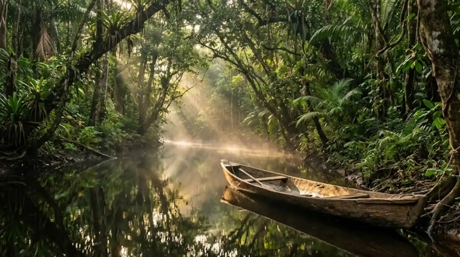
In the Amazon, the word that best captures the bond between people and water came neither from Portuguese nor from English. It came from Tupi. An igarapé is a narrow, shallow watercourse that runs under the shade of the forest and eventually feeds the great rivers. The name joins igara, canoe, and apé, path or route, so it translates literally as canoe path. It does not merely describe a landscape feature: it describes a function. For the people who first named those waters, the smaller channel was not a minor detail of the scenery, it was a traffic route.
The Amazon rainforest is often pictured as an impenetrable green maze, yet for the Indigenous peoples who have lived there for millennia it has always been an integrated, carefully charted territory. Instead of dirt or stone roads, their geographic engineering relied on the vast water network that cuts across the region. The most revealing linguistic clue to that relationship is stored inside the word igarapé itself, which shows how Indigenous peoples read and organised space through their navigation flows.
A word that works as a classification system
To the modern urban eye, a small stream is a secondary accident of the terrain, something that often does not even earn a name on a map. For Tupi speaking peoples, by contrast, every branch of water was at once a transport route, a trade path, a food source and a decisive reference point for survival. Calling that channel a canoe path meant writing a practical decision into the language itself: water, rather than dry land, is the communication infrastructure of the forest.
The structure of the word shows how precise that classification was. Igara names the canoe, usually carved from a single trunk, a refined technology of buoyancy and endurance. Apé names the path, the road, the route. Joining the two pieces, the language does not sort water by its size or its volume, but by what it allows people to do: navigate. It is a functional taxonomy, as logical as the difference we now draw between a motorway and a neighbourhood street.
Sheltered routes under the canopy
Unlike the great rushing rivers such as the Amazon and the Solimões, which could bring dangerous currents and wind storms, igarapés offered routes sheltered beneath the tree cover. According to linguistic and historical research, mapping those small channels allowed communities to travel hundreds of kilometres while avoiding the hazards of open water, using shortcuts that linked different river basins. The canoe paths were, in that sense, the safe arteries of a complex network of traffic between peoples.
The beating heart of the village
Igarapés were never only passageways. Choosing where to build a new community depended directly on the presence of a navigable canoe path with clean water. Narrower and shallower than the main rivers, those courses concentrated an extremely rich biodiversity in a small stretch of space, which made that abundance unusually easy to reach for anyone living on the bank.
Available studies indicate that igarapés act as nurseries for countless species of fish, amphibians and insects, and that they also draw land mammals looking for water and food along the damp margins. For Indigenous peoples that meant a steady, reachable source of protein, obtained through small scale fishing and subsistence hunting. Silent navigation along the calm waters of an igarapé let hunters approach animals on the bank without noise, using the current itself to their advantage.
A map kept in memory and in names
Indigenous mapping of the Amazon was never recorded on parchment or on paper charts. It was engraved in collective memory and passed down through oral tradition, one generation at a time. The name of each igarapé worked as a living geographic coordinate. Place names referred to the physical qualities of the water, to particular trees growing on the banks, to animals common in the area, or to historical events that had happened there. To name was, quite literally, to map.
That ancestral knowledge also covered the seasonal shifts of those liquid roads. During the flood season, igarapés spill over and push into the forest, forming the igapós, the flooded woodlands. The canoe path then widens and lets travellers steer between tree trunks to gather ripe native fruit straight from the low canopy. In the dry season, the retreat of the water demands exact knowledge of where the channel is still navigable and where the canoe will have to be dragged over sandbanks or fallen trunks.
Black, clear and muddy water
Indigenous classification went further still, sorting canoe paths by the natural chemistry of the water. Blackwater igarapés, loaded with organic acids released by decomposing leaves and branches, are typically more acidic and host fewer mosquitoes, which makes their banks ideal places to camp. Clearwater and muddy igarapés, by contrast, point to links with springs from different geological formations, showing higher turbidity and a rich concentration of mineral nutrients that sustains large numbers of migrating fish.
Read together, those categories describe something close to a working hydrological vocabulary. A single name can tell a traveller whether a channel can be paddled, what kind of water will be found there, which fish are likely to gather in it, and whether the bank is a comfortable place to spend the night. Written records were never needed for that knowledge to circulate with precision, because the information was already carried inside the names themselves.
What disappears when the path does
Today the integrity of those historical canoe paths is seriously threatened by the transformations under way in the Amazon. Advancing deforestation for pasture and monoculture destroys the riverside vegetation that shields the headwaters and the banks of igarapés. Without plant cover, the soil erodes and earth is carried into the channels, producing silting. That process reduces the depth of the igarapé, gradually turns it unnavigable and destroys its original role as a connector.
Pollution from agricultural chemicals and the mercury used in illegal mining also poisons waters that were once crystalline, affecting wildlife and the human populations that still rely on them to drink, cook and fish. When an igarapé dies or dries up, it is not only an ecosystem that is lost: a historical road linking riverside and Indigenous communities to their ancestral territories is erased as well. Saving igarapés means preserving the cartographic memory and the cultural viability of the region.
The word igarapé invites us to see the forest not as a demographic void waiting to be conquered, but as a space intensely lived in, named and respected. Indigenous canoe technology and the cartography held inside the Tupi language show that development in the region has always been tied to the conservation of its natural flows. Protecting those water roads is an essential commitment to securing the future of the forest, and a way of honouring those who first learned to read the paths drawn by the water.
Reporting: Anne Silva / Amazonia Mag. Source: Museu Paraense Emílio Goeldi; National Indigenous Peoples Foundation (FUNAI).

Editor · Amazonia Mag
Anne Silva is the editor of Amazonia Mag, the English-language edition of Revista Amazônia. She curates, translates and adapts the outlet's science and environment coverage for an international audience, reporting on Amazon wildlife, flora, rivers, climate and research. Every story she edits is grounded in peer-reviewed studies, official data and on-the-ground reporting from the Revista Amazônia newsroom in Belém, Pará, Brazil. More by Anne Silva →