
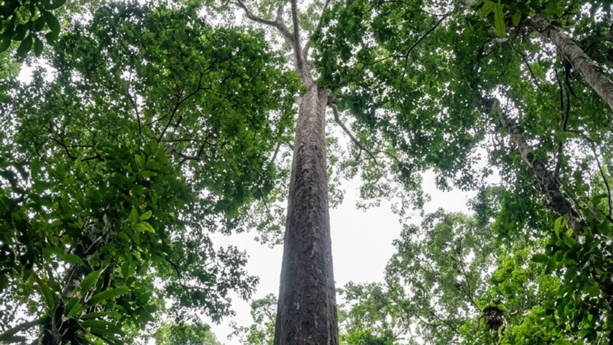
In 2019, satellite imagery used in a three-dimensional map of the forest pointed to trees far taller than the norm in southern Amapá, in the Brazilian Amazon. Among the spots identified was a red angelim that, years later, would be measured at 88.5 meters (about 290 feet). That mark made it the tallest tree known in the Amazon. The story began far from the trunk, the crown and the ground where the tree stood. First it appeared as an exceptional reading in remote-sensing data. Then it began to guide a field investigation in a state forest located between Pará and Amapá.
A crown far above the usual showed up on the map
The research started from studies by Professor Eric Bastos, carried out with groups from the National Institute for Space Research, known as Inpe. The three-dimensional mapping made it possible to recognize trees that stood out for their height, but the image could not replace direct checking. Someone had to reach the indicated spot, identify the species and measure the individual with suitable methods.
Until that verification, the tall crown was only a hypothesis. Remote sensing could say that something unusual stood out above the canopy, but it could not say which species it was, how thick its trunk was or whether the reading was accurate. Each of those answers had to come from the ground.
In this way the record moved from a sign picked up at a distance to a stage of confirmation on the ground. The sequence also shows how different tools can be combined to locate structures that the forest keeps partly hidden under its canopy.
The expedition took three years to reach the trunk
The tree was reached in 2022, when an expedition of the Giant Trees Project (Projeto Árvores Gigantes) arrived at the place pointed out by the studies begun in 2019. Three years separated the remote identification from the scientists’ arrival at the tree. In that time the information stopped being only a coordinate tied to a tall crown and became the subject of direct investigation in a state forest between the two Amazon states.
The expedition was the moment when the team could check the individual, observe its structure and apply measuring instruments on the spot.
The fieldwork used two different procedures. The height was measured with Lidar, a technology that gathers information on distance and relief by means of pulses of light. The circumference of the trunk was checked with a tape. Combining the methods made it possible to record different dimensions of the same tree, without treating the height estimated in the imagery as the final result.
The work brought together the Giant Trees Project and institutions that supported the research, among them the Jari Foundation, Swansea University, Norte Solar, Imazon, the Federal Institute of Amapá and the Federal University of the Jequitinhonha and Mucuri Valleys.
The red angelim reached 88.5 meters
The tree is a red angelim, a species whose scientific name is Dinizia excelsa. The measurement recorded a height of 88.5 meters (about 290 feet), which puts it above the other Amazonian trees known in the survey. The trunk also had a circumference of 9.9 meters (about 32.5 feet), a figure taken with a tape during the expedition. These numbers define the record in two different dimensions: height shows where the crown stands in relation to the ground, while circumference reports the size of the trunk at the point measured.
The most important word for interpreting the result is “known.” According to the research data, the red angelim is the tallest tree on record among those known in the Amazon, but the ranking depends on verified measurements and on the trees located up to that moment. Satellite imagery was decisive in finding trees outside the pattern, yet confirmation required Lidar and measurement on the ground.
Nor should the 88.5-meter mark be turned into a typical height for the species or for the forest. The number belongs to one specific individual, measured in one particular area.
A discovery made at two scales
The result links two scales of observing the Amazon. From above, three-dimensional mapping picked up signs of crowns that stood out in southern Amapá. On the ground, the expedition found the red angelim and confirmed its dimensions. The outcome is a concrete record of the tallest known Amazon tree, along with a demonstration of the role of remote sensing in locating specimens that would be hard to find by wandering at random through the forest. The discovery did not happen in a single instant but in a chain made of image analysis, planning, travel and measurement.
The case also brings technology closer to fieldwork without replacing direct observation. The satellite pointed to the area, Lidar measured the height and the tape recorded the circumference. Each resource answered one part of the problem and produced a verifiable result for that individual.
Between 2019 and 2022, an occurrence detected in space-based data became an identified tree, located between Pará and Amapá and recorded at 88.5 meters. A crown that first appeared as a difference on a map came to have a species, a trunk and a measurement. In the Amazon, getting to know a tree can start well above it, in the space where the forest turns into an image.
Reporting: Natália Santos / Amazonia Mag

Editor · Amazonia Mag
Anne Silva is the editor of Amazonia Mag, the English-language edition of Revista Amazônia. She curates, translates and adapts the outlet's science and environment coverage for an international audience, reporting on Amazon wildlife, flora, rivers, climate and research. Every story she edits is grounded in peer-reviewed studies, official data and on-the-ground reporting from the Revista Amazônia newsroom in Belém, Pará, Brazil. More by Anne Silva →