
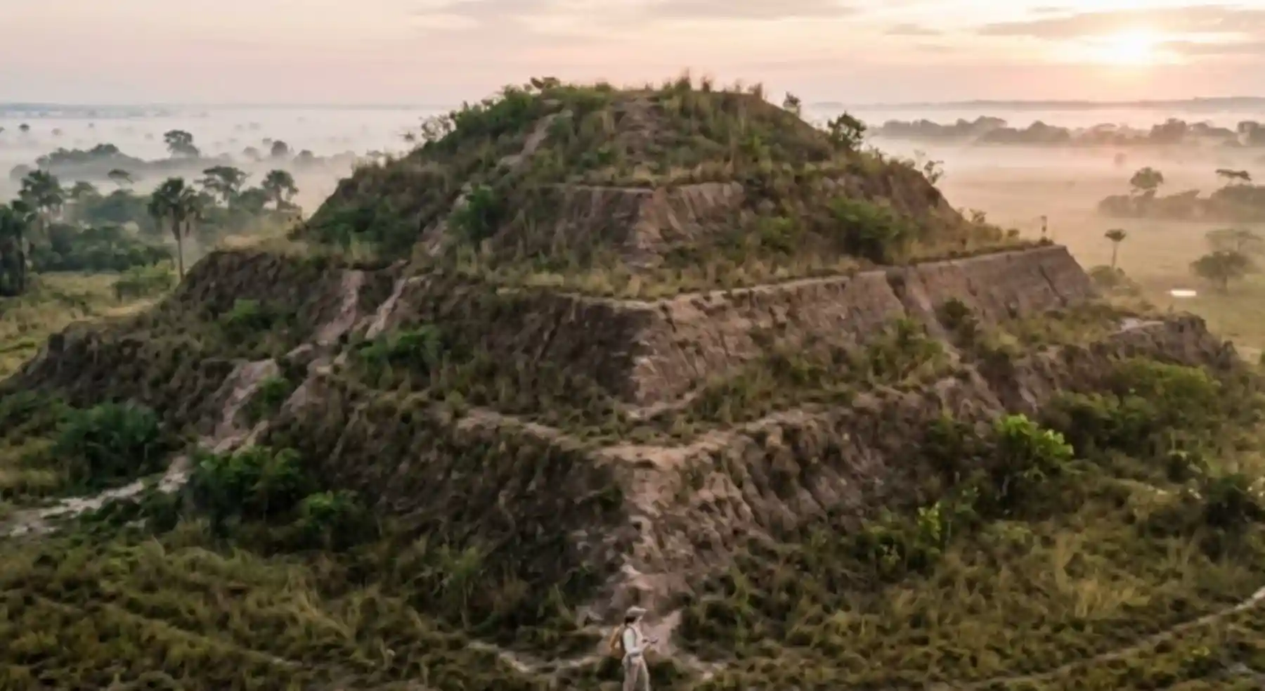
For decades, the world’s largest rainforest kept its own architecture hidden beneath a canopy no conventional sensor could see through. That changed when archaeologists began flying LiDAR equipment over the Amazon basin. Where researchers once saw only an unbroken roof of treetops, they now map monumental platforms, geometric earthen mounds shaped like pyramids, straight causeways and drainage systems. This is not a single isolated find. It is an entire landscape of earthworks that forces a revision of the history of engineering in the Americas.
The starting point of that revision was already in the ground. The Amazon basin holds vast stretches of terra preta, an extremely fertile soil of human origin, created and maintained by ancient populations over centuries. That biological and archaeological fact contradicts the idea of an untouched forest waiting for European arrival. The dark earth is not ordinary organic residue. It is evidence of complex soil engineering, capable of sustaining dense populations in an environment long dismissed as unproductive.
How the laser learned to look under the canopy
LiDAR, short for Light Detection and Ranging, has been the catalyst of this shift. The technology fires thousands of laser pulses from an aircraft or a drone and measures how long the light takes to bounce back from the ground. By filtering out the returns that hit leaves and branches, scientists build digital terrain models of remarkable precision. It is as if modern archaeology had gained the ability to lift the veil of the forest and expose the ancient infrastructure underneath.
Before LiDAR, fieldwork in the Amazon was a monumental and dangerous task. Teams had to cut trails by hand through dense vegetation just to survey small patches of ground, and an entire season of effort could end with a handful of scattered finds. Today, areas that would take decades to walk can be scanned in a matter of days. The resulting images do not show one lost city standing alone. They show a continuous human-shaped landscape, a network that wove housing, farming and infrastructure together long before the modern idea of urban planning existed.
Pyramids of earth, not of stone
Among the structures the laser brought to light are large geometric forms resembling pyramids and ceremonial platforms, identified in regions such as Acre and Mato Grosso, in Brazil. It is worth stating this with the precision the finding deserves. These are not stone funerary temples like those of Egypt, nor the pyramids of the Yucatan. They are complex constructions of earth and clay that served as political, religious and administrative centers for the societies that built them.
The difference in material does not diminish the achievement. It redefines it. Raising a monumental earthen mound demands an understanding of soil mechanics, of regional hydrology and of how ground behaves under months of heavy rain. It also demands organizing a massive workforce to move tons of sediment. The existence of these structures points to stratified societies with a ruling class, specialists and an organization able to plan and deliver infrastructure that survived centuries of forest regrowing on top of it.
Straight causeways: the network that ties it together
If the mounds impress by their scale, the road network impresses by its connectivity. The data revealed thousands of kilometers of routes linking separate settlements. These were not winding trails worn in by repeated use. They were wide, straight and often raised above ground level, built to last and to move people and goods, perhaps seasonally to manage resources, perhaps for ceremonial purposes.
Laying a straight route for kilometers across forested terrain is no small detail. It requires knowledge of geometry, the ability to fix distant reference points and genuine territorial planning. By connecting the centers holding pyramids and platforms to outlying areas of cultivation and gathering, these civilizations built a decentralized urban system, a forest urbanism that combined human density with local ecology. Studies indicate this model allowed large populations to live in the region without causing the wholesale deforestation seen today, a result that challenges assumptions about both ancestral and modern sustainability.
Dark earth as the signature of that occupation
The terra preta is perhaps the most tangible legacy these societies left behind. Creating a fertile, durable soil in an environment that leaches nutrients away is an engineering secret modern science still struggles to reproduce efficiently. Understanding that pre-Columbian management is not an exercise in nostalgia. It is working material for the region’s bioeconomy today.
Instead of building agriculture on cutting and burning standing forest, the archaeological findings suggest that intensive management of specific areas, grounded in ancestral soil engineering, may be a path toward sustainable human occupation. What the forest concealed was not only monumental structures. It was evidence of a development model that did not require destroying the ecosystem.
What this changes in the pre-Columbian debate
For decades, the historical narrative placed the great pre-Columbian civilizations in the Andes, with the Inca, and in Mesoamerica, with the Maya and the Aztec. The Amazon appeared as a peripheral region without a history of its own. The earthworks LiDAR keeps recording place the basin at the center of that discussion. The absence of stone monuments is not proof of lesser complexity. It is proof of intelligent adaptation to an environment where earth and wood were the most abundant building resources available.
We are beginning to understand that the Amazon was never a cultural vacuum, but a crucible where unique and complex civilizations developed. The region was not merely a secret the forest kept. It was a center of technical innovation in its own right, one researchers have only started to rediscover.
An open-air archive under threat
None of this is academic curiosity. Knowing that the Amazon was home to complex, populous societies that managed the forest for centuries changes what the term pristine forest means and what counts as viable human occupation there. It also changes the urgency of the work. Degradation is advancing over sites that have not yet been mapped and that may vanish before anyone studies them. Technological archaeology stops being a convenience and becomes an ethical imperative.
That is why democratizing these tools matters. Traditional communities and Indigenous peoples, who often hold deep knowledge about these places, should have access to the technology that protects their territories and their legacy. The greatest inheritance to leave the next generations is not only an archive of data about what once existed, but a living forest, monitored and protected, with its history still inside it.
Reporting: Anne Silva / Amazonia Mag. Source: Revista Amazônia.

Editor, English Edition — Amazonia Mag
Anne Silva is the editor of Amazonia Mag, the English-language edition of Revista Amazônia. She curates, translates and adapts the outlet's science and environment coverage for an international audience, reporting on Amazon wildlife, flora, rivers, climate and research. Every story she edits is grounded in peer-reviewed studies, official data and on-the-ground reporting from the Revista Amazônia newsroom in Belém, Pará, Brazil. More by Anne Silva →